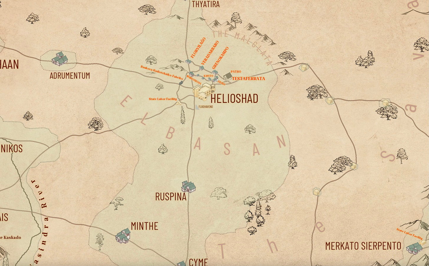
Well, it’s hard putting out a couple thousand words (and more) a day, and work, and have no personal life but plenty to do anyway, and sometimes I gotta scramble. Thus today, a special Map.
Besides, this is useful information. You can guess that the map is growing more elaborate, and don’t fear, I’ll have a post of that one of these Mondays soonish (when it is more elaborate still). The Elbasan is the central agricultural region north of the Aulis area … The green highlighted (highlit?) area indicates dense terraforming—i.e., it looks like Earth and any native plants or terrain are accidental. Drop you in there and claim it was south-central France or something, and you wouldn’t know you weren’t home until the moons came up. The light brown regions mean different things, depending. On the left there, that’s spottier agriculture and unterraformed territory. On the right, some unterraformed areas and the savano—a reconstructed African savannah, which is slowly spreading east and north. Those green isolates and structures on the right? Coffee plantaos. Avoid them.
The Helioshad area is getting more detailed, and Ruspina and Adrumentum erupted out of nowhere in the past few days. Understand this is densely settled. There are at least as many towns (clusters of green-roofed buildings) and cities (brown boxy conglomerates) out there as indicated already. Given time, this will be pretty complicated-looking.
Frankly, Helioshad is assuming more and more importance as time goes on.
As for distances, off the cuff, I think Ruspina is about three hundred kilometers south of Helioshad.


Parrish, I am so damn jealous of your imagination. And btw, my choice (and favorite name) for an abode would be Merkato Sierpento. Although State Labor Facility sounds a little ominous, it's near the mountains. - Jim